
We all know that the Hamptons are an island unto itself. But with the Shinnecock Canal, the Hamptons might have literally separated the South Fork from Long Island!
Most Long Islanders think of the island as a continuous stretch of land running from Brooklyn to Montauk.
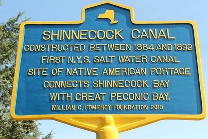
In 1892, the opening of the Shinnecock Canal at Hampton Bays created a waterway between Great Peconic Bay and Shinnecock Bay. The project became New York State’s first saltwater canal and established a navigable route across the South Fork.
Today, the canal is crossed by Sunrise Highway, Montauk Highway, and the Long Island Rail Road’s Montauk Branch. For many travelers heading east, the canal crossing marks the transition into the South Fork and serves as an informal gateway to the Hamptons.
From Niamuck to Canal
Long before the canal existed, the area was known by the Native name Niamuck.
The location later became known as Canoe Place, reflecting its role as a portage route between Great Peconic Bay and Shinnecock Bay. For generations, Indigenous travelers carried canoes across the narrow strip of land separating the two bays, avoiding the much longer trip around the South Fork.
Both names reflected the same geographic reality. This was one of the shortest distances between the waters north and south of the South Fork.
The idea of creating a permanent water connection at this location long predated the canal itself. Records show Southampton officials were discussing efforts to create an outlet for Shinnecock Bay as early as 1652, more than two centuries before construction began.
By the late nineteenth century, state officials, fishermen, and business interests began advocating for a canal that would create a permanent water connection between the bays.
Construction began in 1884, but weather, funding shortages, and storm damage repeatedly delayed the project before the canal finally opened to navigation in 1892.
When the Shinnecock Canal opened to navigation in 1892, it stretched approximately 4,700 feet, just under nine-tenths of a mile, and created New York State’s first saltwater canal.
New York State’s First Saltwater Canal
When the canal opened to navigation in 1892, it became New York State’s first saltwater canal.
The project connected Great Peconic Bay and Shinnecock Bay through a navigable waterway for the first time, creating a direct route between the waters north and south of the South Fork.
The canal quickly became an important transportation link for commercial vessels, fishermen, and recreational boaters.
Its significance extended beyond navigation. By connecting two major bodies of water, the canal altered water circulation in the surrounding bays and became a lasting part of Long Island’s maritime economy.
More than 130 years later, the canal remains in operation and continues to serve boaters traveling between Peconic Bay and Shinnecock Bay.
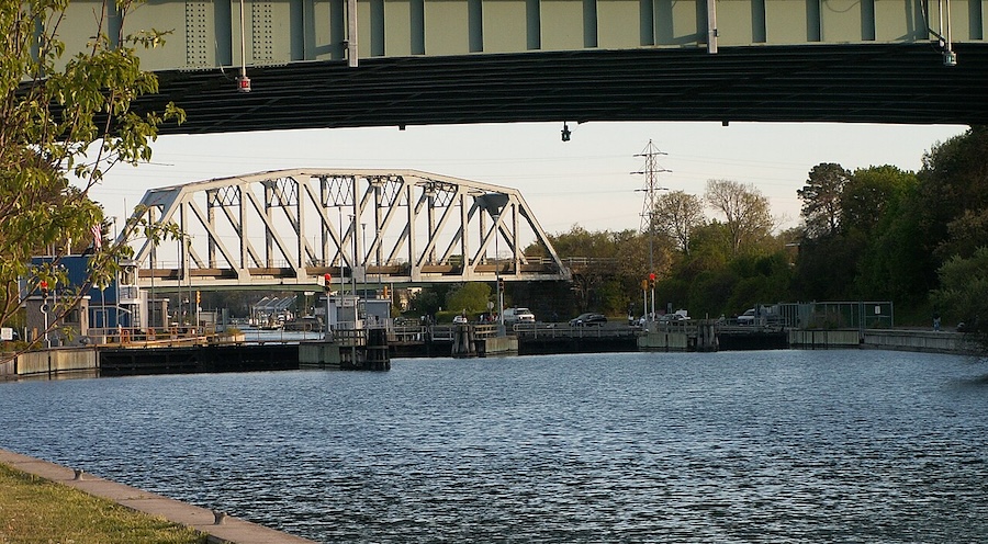
Photo: Roger Rowlett, CC BY-SA 2.5, via Wikimedia Commons
How the Canal Changed the Map
Before 1892, the South Fork was connected to the rest of Long Island by uninterrupted land.
After the canal opened, water extended from Great Peconic Bay through the Shinnecock Canal to Shinnecock Bay.
To the north lay Peconic Bay.
To the south lay Shinnecock Bay and the Atlantic Ocean.
To the east were Gardiners Bay, Block Island Sound, and the Atlantic.
Roads, rail lines, and bridges make the geography easy to overlook today. Southampton, Bridgehampton, Sag Harbor, East Hampton, Amagansett, and Montauk remain firmly part of Long Island culturally, economically, and politically.
Yet since 1892, anyone traveling into those communities has crossed a man-made channel that did not previously exist.
A Long Island Geography Debate
The opening of the canal created an unusual geographic situation.
Before 1892, the South Fork was connected to the rest of Long Island by uninterrupted land. The canal created a navigable water route between Great Peconic Bay and Shinnecock Bay, leaving communities east of the canal on the opposite side of a man-made waterway.
Brooklyn and Queens are geographically part of Long Island, despite being politically part of New York City.
Because they remain attached to Long Island’s main landmass, Brooklyn and Queens are still connected by uninterrupted land to Nassau County and western Suffolk County.
The South Fork sits beyond the canal.
No one would seriously argue that Brooklyn is more “Long Island” than Montauk. Yet from a purely geographic perspective, Brooklyn and Queens remain attached to Long Island’s main landmass, while travelers heading to Southampton, Bridgehampton, East Hampton, Amagansett, or Montauk cross a man-made waterway that did not exist before 1892.
It is one of those facts that sounds backwards until you look at a map.
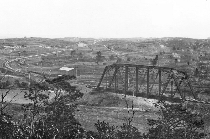
Photo: Shinnecock Canal bridge, Canoe Place and North Highway crossing zoom view SE in 1904. Photo: Hal B. Fullerton Archive: Queens Public Library
The Only Navigation Lock on Long Island
The canal’s story did not end in 1892.
By the early twentieth century, concerns emerged about water conditions in Shinnecock Bay and their impact on shellfish populations. Additional improvements began in 1918, including tide-control structures and later the lock system that remains in operation today.
The lock helps regulate water levels and allows vessels to move between the two bays. Today, it remains the only operating navigation lock on Long Island.
The lock also helped maintain the salinity of Shinnecock Bay, supporting shellfish populations that were important to the local economy.
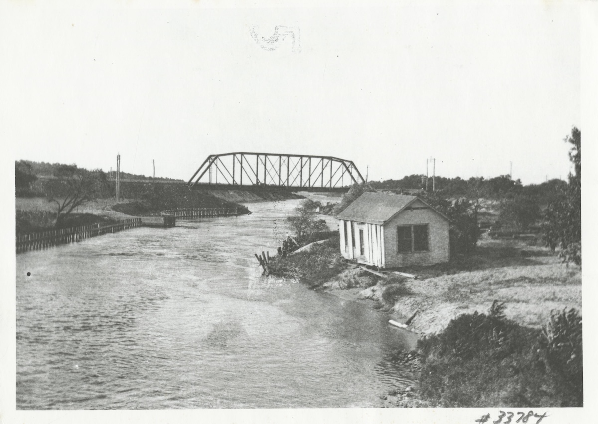
Photo: Thomas R. Bayles. 1915. Shinnecock Canal at Hampton Bays in 1915. Gelatin silver print
Rum Runners at the Canal
The Shinnecock Canal played an unexpected role during Prohibition.
Historical accounts describe rum runners using the canal to unload illegal cargo, with shipments reportedly transferred to well-camouflaged trucks in Good Ground, now Hampton Bays, for transport toward New York City.
Long before it became known primarily as a boating destination, the canal was part of a smuggling network that moved alcohol across Long Island during the 1920s and early 1930s.
The Hurricane That Changed the Bay Again
The canal’s environment changed dramatically in 1938 when the Great Hurricane opened Shinnecock Inlet through the barrier beach south of the bay. In many ways, the storm accomplished what local officials and residents had been attempting for more than a century by creating a direct connection between Shinnecock Bay and the Atlantic Ocean.
The inlet remained open and was later stabilized, creating the connection that exists today.
Together, the inlet and canal reshaped water circulation throughout the area and helped define the waterways that boaters still use.
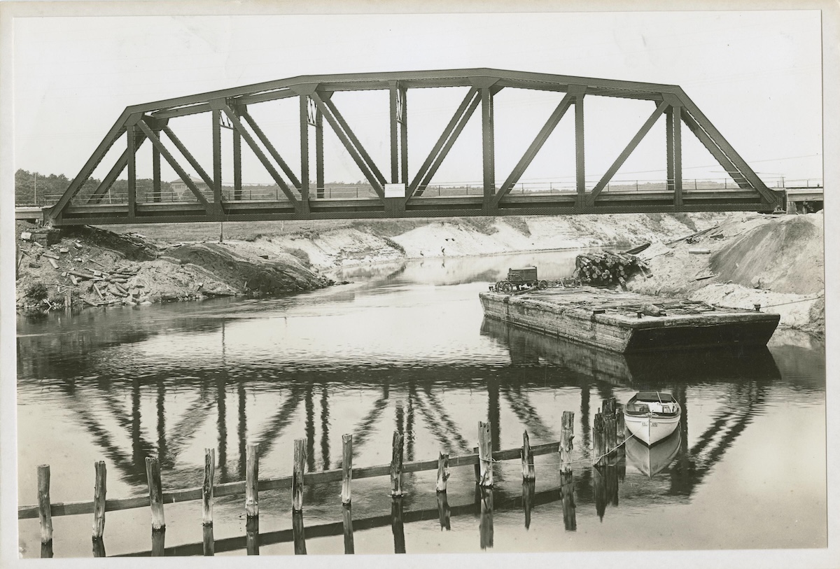
The Shinnecock Canal Bridge under construction in Hampton Bays on July 15, 1931. Looking north along the canal, the photograph captures a period when the waterway was already nearly 40 years old and serving as a vital connection between Great Peconic Bay and Shinnecock Bay. Photo by William J. Rugen, courtesy of the William J. Rugen Image Collection, Queens Public Library.
Still Working More Than 130 Years Later
More than a century after its completion, the Shinnecock Canal remains an active part of Long Island’s maritime infrastructure.
Thousands of vehicles cross above it every day. Boaters continue to use the canal and lock system, just as they have for generations.
Most travelers heading east are focused on reaching Southampton, East Hampton, or Montauk.
Few stop to think about the waterway below.
Yet the canal remains one of the few places where a man-made waterway visibly altered Long Island’s geography, creating a distinction that still exists more than 130 years after workers first cut through the narrow strip of land at Canoe Place.
Sources
- William G. Pomeroy Foundation Historic Marker Program, “Shinnecock Canal”
https://www.wgpfoundation.org/historic-markers/shinnecock-canal/ - Native Long Island, “Niamuck”
https://nativelongisland.com/listing/niamuck/ - Noble E. Whitford, History of the Canal System of the State of New York (1906), Chapter XII: Shinnecock and Peconic Canal
https://eriecanal.org/texts/Whitford/1906/Chap12.html - The New York Times, “Canal on Long Island,” June 21, 1892
- Town of Southampton, Shinnecock Canal Public Access Sites and Maritime Planned Development District Study, Section III: History
https://www.southamptontownny.gov/DocumentCenter/View/1280/Section—03?bidId= - Southampton Town Historical Museum and Southampton Town historical materials regarding Canoe Place and the Shinnecock Canal
- U.S. Army Corps of Engineers, Shinnecock Canal and Lock historical information
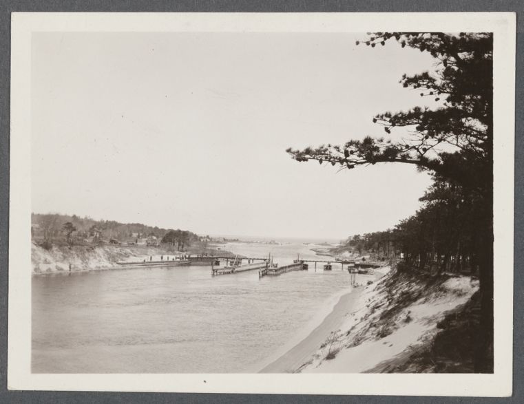
Cover photo: The Shinnecock Canal at Canoe Place in Southampton, photographed in April 1927. Long before the canal connected Great Peconic Bay and Shinnecock Bay, this location was known as Canoe Place, where Indigenous travelers carried canoes across the narrow strip of land between the two waterways. Photo by Eugene L. Armbruster, courtesy of The New York Public Library Digital Collections. Citation: Eugene L. Armbruster, View of Canal at Canoe Place. Connecting Shinnecock Bay with Peconic Bay, looking north. Canoe Place, Southampton (April 1927), The New York Public Library Digital Collections. https://digitalcollections.nypl.org/items/aa8b5ca0-f9b0-013c-03cc-0242ac110003
